


Val de lEndre

aljac
User
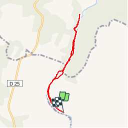

Length
6.7 km

Max alt
123 m

Uphill gradient
101 m
Km-Effort
8.1 km

Min alt
47 m

Downhill gradient
103 m
Boucle
No
Creation date :
2019-06-04 12:19:04.744
Updated on :
2019-06-04 16:09:58.857
3h50
Difficulty : Very easy

FREE GPS app for hiking
 SityTrail
IGN / Geographical institutes
SityTrail Plus
The world is yours!
About
Trail Walking of 6.7 km to be discovered at Provence-Alpes-Côte d'Azur, Var, Le Muy. This trail is proposed by aljac.
Positioning
Country:
France
Region :
Provence-Alpes-Côte d'Azur
Department/Province :
Var
Municipality :
Le Muy
Location:
Unknown
Start:(Dec)
Start:(UTM)
304435 ; 4821437 (32T) N.
Comments
Parcours chaotique dans le lit de l'Endre ou à proximité. Il faut se frayer un passage dans la végétation et ne pas hésiter à se mouiller les pieds.